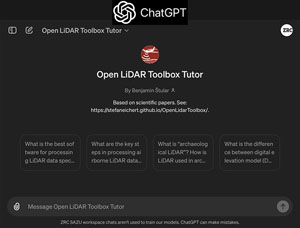
OLiT-T: Open LiDAR Toolbox Tutor

OLiT-T is an AI chatbot designed to converse on the topic of archaeology-specific processing of airborne LiDAR data. However, it will be useful to anyone using the Open LiDAR Toolbox and more widely to anyone interested in high-precision and high-transparency processing of LiDAR data.
OLiT-T was trained on the authors' published scientific work on archaeological LiDAR which are listed at the bottom and OLiT's documentation. In addition, a Q&A document was also generated specifically for this task.
Currently, OLiT-T is concurrently based on two different platforms, OpenAI's GPTs and Google's VertexAI. They differ in availability, user experience and mode of distribution. Moving on we aim to focus on the one that offers more value.
Keep watching this space for updates.
Roadmap: Sharing OLiT-T's experience and metadata as a good practice example on creating a scientific AI chatbot.
OLiT-T was trained on this scientific content
- Štular, Benjamin, and Edisa Lozić. 2020. "Comparison of Filters for Archaeology-Specific Ground Extraction from Airborne LiDAR Point Clouds", Remote Sensing 12, no. 18: 3025. https://doi.org/10.3390/rs12183025
- Štular, Benjamin, Stefan Eichert, and Edisa Lozić. 2021. "Airborne LiDAR Point Cloud Processing for Archaeology. Pipeline and QGIS Toolbox". Remote Sensing 13, no. 16: 3225. https://doi.org/10.3390/rs13163225
- Lozić, Edisa, and Benjamin Štular. 2021. "Documentation of Archaeology-Specific Workflow for Airborne LiDAR Data Processing",
- Geosciences 11, no. 1: 26. https://doi.org/10.3390/geosciences11010026
- Štular, Benjamin, Edisa Lozić, and Stefan Eichert. 2021. "Airborne LiDAR-Derived Digital Elevation Model for Archaeology", Remote Sensing 13, no. 9: 1855. https://doi.org/10.3390/rs13091855
- Lozić, Edisa. 2021. "Application of Airborne LiDAR Data to the Archaeology of Agrarian Land Use: The Case Study of the Early Medieval Microregion of Bled (Slovenia)", Remote Sensing 13, no. 16: 3228. https://doi.org/10.3390/rs13
- Štular, B., Lozić, E. 2022, "Airborne LiDAR data in landscape archaeology. An introduction for non-archaeologists", it - Information Technology 64 (6), 247-260.163225. https://doi.org/10.1515/itit-2022-0001
- Štular, B. 2022, "Scientific Dissemination of Archaeological Interpretation of Airborne LiDAR-derived Data". In: K. Garstki (ed.), Critical Archaeology in the Digital Age. 12th IEMA Visiting Scholar Conference, Los Angeles, CA, 111-122. https://doi.org/10.2307/j.ctv2fcctzd.14
- Štular, B., Lozić, E., Eichert, S. 2023, "Interpolation of airborne LiDAR data for archaeology", Journal of Archaeological Science: Reports 48, 103840. https://doi.org/10.1016/j.jasrep.2023.103840
- Štular, B., Lozić, E. 2023, "Executable Map Paper (EMaP) for Archaeological LiDAR", Journal of Computer Applications in Archaeology 6 (1), 79-95. https://doi.org/10.5334/jcaa.106
- Štular, B., Lozić, E., & Eichert, S. (2024). "Open LiDAR Toolbox Documentation", Zenodo. https://doi.org/10.5281/zenodo.11091455
- Štular, B., & Lozić, E. (2024, April 30). "Open LiDAR Tutor: FAQ", Zenodo. https://doi.org/10.5281/zenodo.11091241
Links
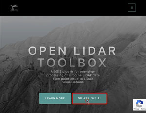
Try it on our webpage, click 'Ask the AI'
Test also
- BmyRAG. Data Conversations Made Easy
- ArkasAI Data Analyst. Analyse archaeological sites of Slovenia